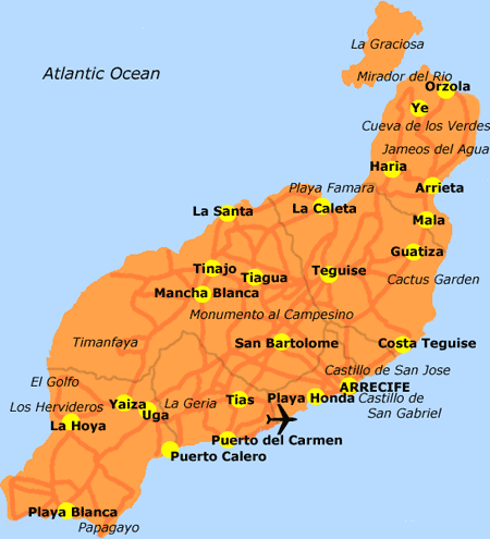
Lanzarote Island
Lanzarote, called 'Conejera' by the islanders, is also known as the island of 100 volcanoes. Its volcanic origin has created a landscape with more than 300 volcanoes. It is the most eastern island of the Canarian archipelago and it is situated very close to the African coast (which is some 125km away) and north of Fuerteventura. The surface of the island measures 846km2, and its widest point is some 21km across. To the north of the island, we find a group of small islands, La Graciosa, Alegranza, Montaña Clara, Roque del Este and Roque del Oeste, which form the Chinijo archipelago.
Where does the name come from? The island receives the name of Lanzarote from the Genovese sailor, Lancelotto Malocello, one of the first explorers of the island. Titeroygatra is the original name by which the original inhabitants knew the island. It means 'the coloured hills' - so-called for the red colour of its landscape.
Weather & Climate
Warm temperatures all year. With a good deal of flatland, Lanzarote is the least mountainous of the Canary Islands. Due to its low level, Lanzarote is below the level of humid and warm air. In general, this results in a dry climate with little rain. The average temperature is 24° in August and 17° in January. The sea temperature varies between 17° and 24° at the surface. The sun shines for many hours throughout the year, which allows sun worshippers to enjoy the long white-sand beaches and clear waters: those of Famara, Papagayo, Orzola, Puerto del Carmen or Las Cucharas. The wind is constant and moderate almost all year, making Lanzarote a suitable place for the practice of yachting, windsurfing and kitesurfing.
To check out the latest weather click here
Landscape
Typical landscape. The palm trees, almost the only kind of native tree life, are found in the banks of the barrancos and the bottoms of the valleys. The palm groves of Haria, situated on the outskirts of the village, deserve a special mention.
In general, the island possesses a vegetation composed of species that are adapted to living in hard conditions due to the lack of rain, poor terrain and wind. For this reason, the farmer has had to look for alternatives in order to develop agriculture of the island. For this reason, the arenados have been extended and the red and ochre land of Lanzarote has been tinted with black, giving a different look and feel to the landscape. The landscape of the island is not only influenced by natural factors or by the geological evolution of the island, but also by the influence of man; that is, the way of cultivating of La Geria - all of which is designed to cope with a sub-desert climate. However, even though it is such a dry island with few features, it possesses an endemic range of plants as beautiful and rare as on any of the islands.
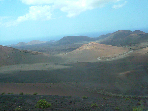
The lava fields make up a botanical environment of great importance. Of special note are the lava fields in the National Park of Timanfaya, declared a national park in 1974. The whole island is a great volcanic structure built by successive eruptions on an instable base.
Timanfaya National Park
Something that we should be clear about is that without the volcanic activity, one cannot understand the landscape of Lanzarote: in the past whole populations disappeared and were replaced by
others. The Montañas del Fuego flooded the island with lava forming landscapes as attractive as that of Los Jameos del Agua or La Cueva de los Verdes. Volcanic landscapes, clouds in constant
movement, light and wind, white houses, singular architecture produced by the international artist, Cesar Manrique, crystal-clear waters, beaches of golden sand. All this is characteristic of
Lanzarote. Come and discover it for yourself!
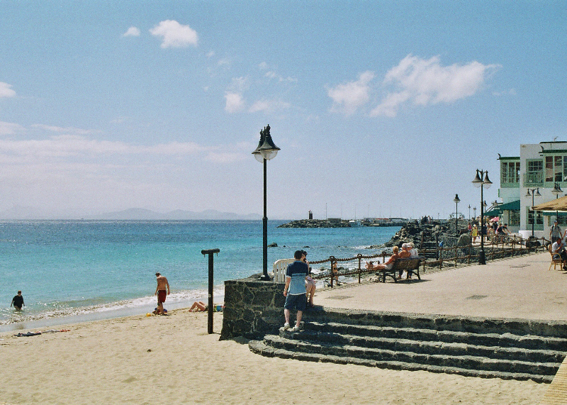
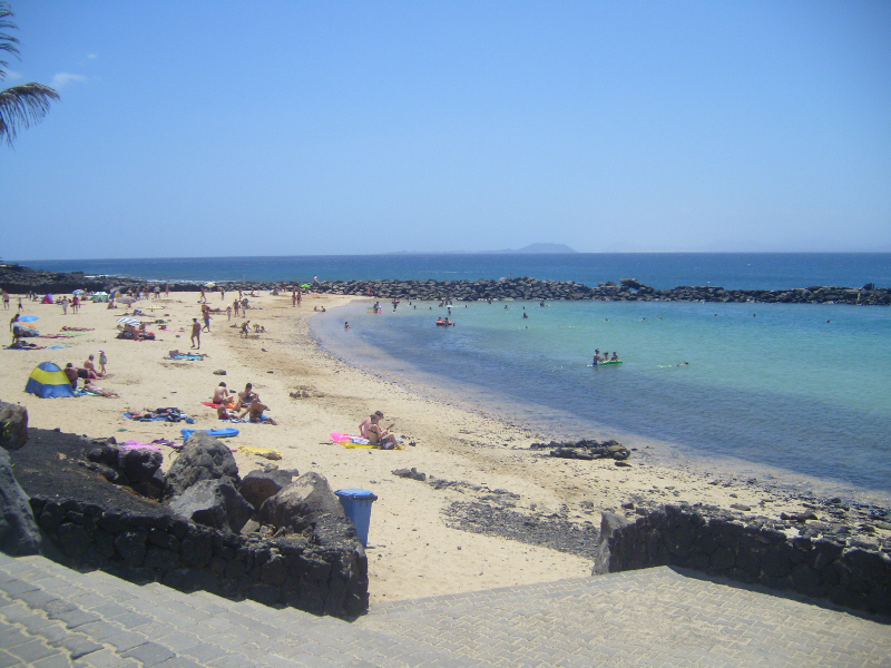
Playa Blanca
Playa Blanca is situated on the south coast of the island and has excellent weather all year round. The area has a beautiful pedestrianised shopping area as well as many seaside bars, cafes and excellent restaurants.
Playa Blanca
The coastline around Playa Blanca is essentially one large 9 Kilometre wide bay which is then broken up into three smaller, but still large, bays. In addition to these local beaches, the famous and spectacular Papagayo beach with it's beautiful white sands, is only a 10-15 minute drive away.
This basic geography means that the beaches in and around Playa Blanca are sheltered and ideal for swimming and sunbathing.
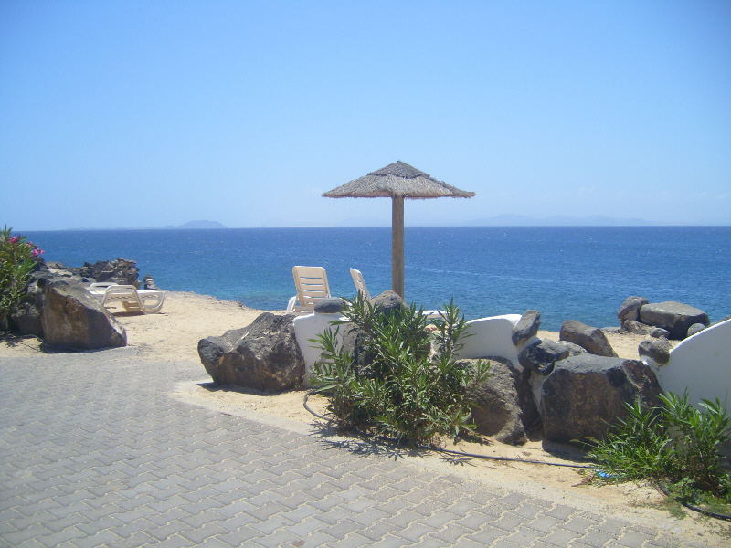
Playa Flamingo Beach
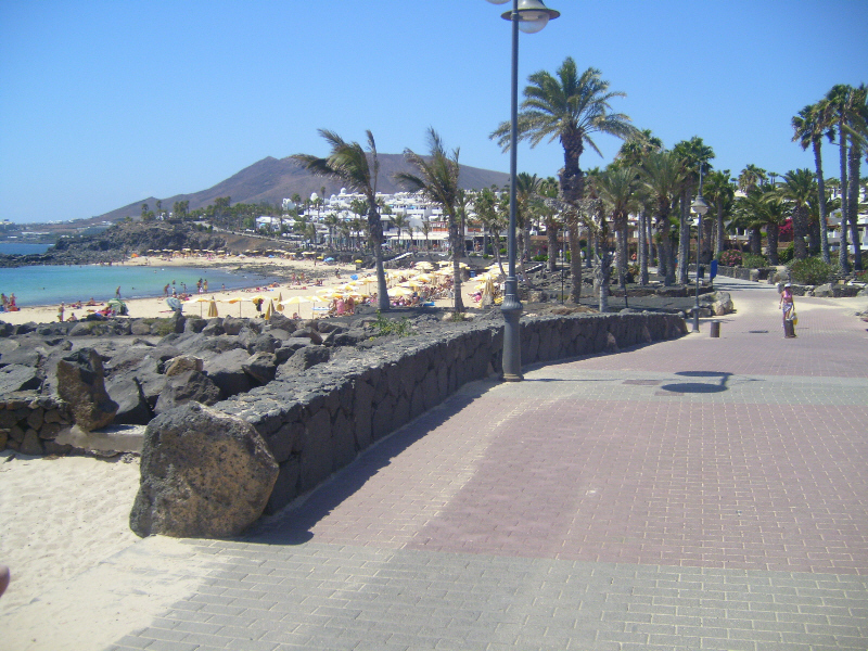
The promenade is well worth taking a walk along as it links both sides of the resort.
The Bocaina Straits
It allows you to take in most of the (sea-front) sites of Playa Blanca as well as spectacular Ocean views of the Bocaina Straits to Fuerteventura.
The Promenade at Playa Flamingo with Montana Roja in the background
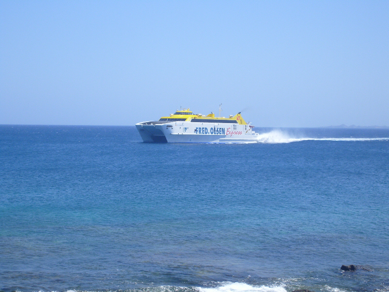
From Playa Blanca harbour you can catch a ferry to the neighbouring island of Fuerteventura.
The Ferry to Fuerteventura
Faro Park (Faro is the spanish word for "Lighthouse"), is located in the southwest corner, a short 5 minute drive from the centre of Playa Blanca. Here, the island has been tastefully developed
with a number of four and five star hotels and luxury villas like "Casa Lauremar".
Facilities within Faro Park include several bars, restaurants, a supermarket, bakery/delicatessen, coffee shops and a gift shop.
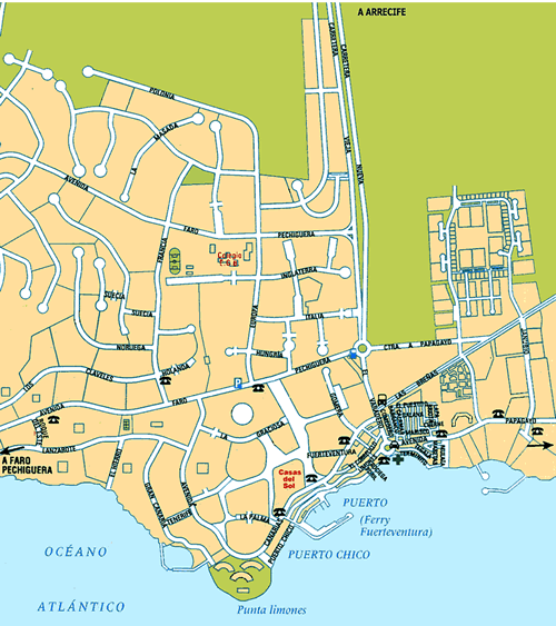
Shopping
Playa Blanca has all the normal tourist shops that you would imagine in the centre and along the central part of of the beach promenade. If you want a more upmarket style of shopping experience, then the new Marina Rubicon is rapidly becoming the place to go.
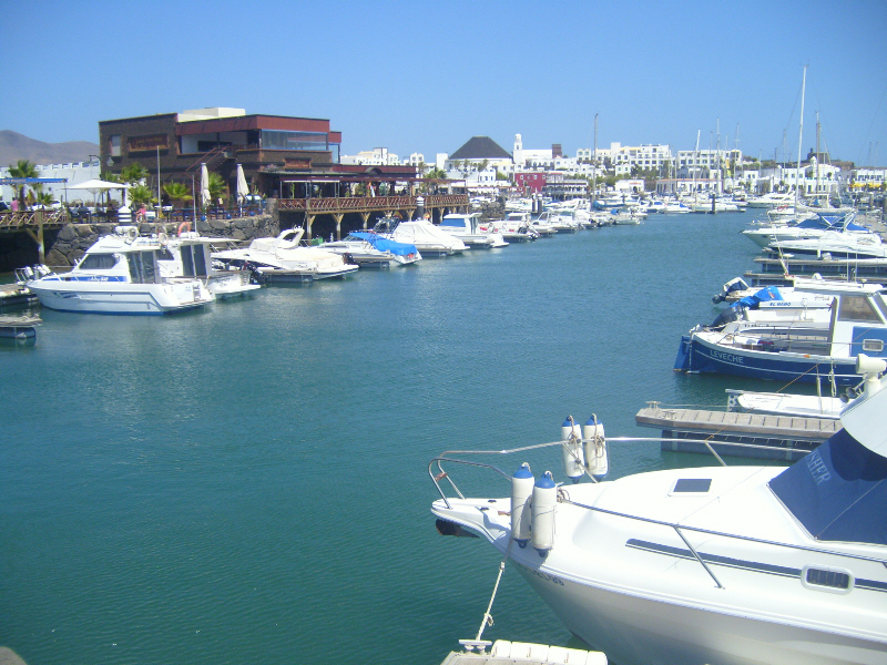
Marina Rubicon
Nightlife
While you can eat and drink in one of the many bars and restaurants in Playa Blanca the tone of the nightlife here is not as riotous as it is in other resorts on the island.